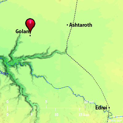
Atlas  Golan and surrounding area Maps Created using Biblemapper 3.0 Additional data from OpenBible.info Occurrences Deuteronomy 4:43 namely, Bezer in the wilderness, in the plain country, for the Reubenites; and Ramoth in Gilead, for the Gadites; and Golan in Bashan, for the Manassites.Joshua 20:8 Beyond the Jordan at Jericho eastward, they assigned Bezer in the wilderness in the plain out of the tribe of Reuben, Ramoth in Gilead out of the tribe of Gad, and Golan in Bashan out of the tribe of Manasseh. Joshua 21:27 They gave to the children of Gershon, of the families of the Levites, out of the half-tribe of Manasseh Golan in Bashan with its suburbs, the city of refuge for the manslayer, and Be Eshterah with its suburbs; two cities. 1 Chronicles 6:71 To the sons of Gershom were given, out of the family of the half-tribe of Manasseh, Golan in Bashan with its suburbs, and Ashtaroth with its suburbs; Encyclopedia GOLAN; GAULONITISgo'-lan (golan), (Gaulanitis): Golan was a city in the territory allotted to Manasseh in Bashan, the most northerly of the three cities of refuge East of the Jordan (Deuteronomy 4:43 Joshua 20:8); assigned with its "suburbs" to the Gershonite Levites (Joshua 21:27 1 Chronicles 6:71). It must have been a great and important city in its day; but the site cannot now be determined with any certainty. It was known to Josephus (Ant., XIII, xv, 3). Near Golan Alexander was ambushed by Obodas, king of the Arabians; and his army, crowded together in a narrow and deep valley, was broken in pieces by the multitude of camels (BJ, I, iv, 4). This incident is located at Gadara in Ant, XIII, xiii, 5. Later, Golan was destroyed by Alexander. It had already given its name to a large district, Gaulonitis (BJ, III, iii, 1, 5; IV, i, 1). It formed the eastern boundary of Galilee. It was part of the tetrarchy of Philip (Ant., XVII, viii, 1; XVIII, iv, 6). The city was known to Eusebius as "a large village," giving its name to the surrounding country (Onomasticon, under the word Gaulon). This country must have corresponded roughly with the modern Jaulan, in which the ancient name is preserved. The boundaries of the province today are Mt. Hermon on the North, Jordan and the Sea of Galilee on the West, Wady Yarmuk on the South, and Nahr `Allan on the East. This plateau, which in the North is about 3,000 ft. high, slopes gradually southward to a height of about 1,000 ft. It is entirely volcanic, and there are many cone-like peaks of extinct volcanoes, especially toward the North It affords good pasturage, and has long been a favorite summer grazing-ground of the nomads. Traces of ancient forests remain, but for the most part today it is treeless. To the East of the Sea of Galilee the soil is deep and rich. Splendid crops of wheat are grown here, and olives flourish in the hollows. The country is furrowed by deep valleys that carry the water southwestward into the Sea of Galilee. This region has not yet been subjected to thorough examination, but many important ruins have been found, which tell of a plentiful and prosperous population in times long past. The best description of these, and of the region generally, will be found in Schumacher's The Jaulan, and Across the Jordan. To him also we owe the excellent maps which carry us eastward to the province of el-Chauran. GOLAN, a city of refuge, its site is not known, but its district was e. of the sea of Tiberias. Strong's Hebrew H1474: Golana city and a region East of the Jordan in Manasseh |


