Atlas
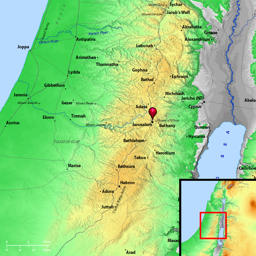
Perez-uzzah (Jerusalem) and surrounding region
Maps Created using Biblemapper 3.0Additional data from OpenBible.infoOccurrences
2 Samuel 6:8 David was displeased, because Yahweh had broken forth on Uzzah; and he called that place Perez Uzzah, to this day.
Encyclopedia
JERUSALEMje-roo'-sa-lem:
I. THE NAME
1. In Cuneiform
2. In Hebrew
3. In Greek and Latin
4. The Meaning of Jerusalem
5. Other Names
II. GEOLOGY, CLIMATE AND SPRINGS
1. Geology
2. Climate and Rainfall
3. The Natural Springs
III. THE NATURAL SITE
1. The Mountains Around
2. The Valleys
3. The Hills
IV. GENERAL TOPOGRAPHY OF JERUSALEM
1. Description of Josephus
2. Summary of the Names of the Five Hills
3. The Akra
4. The Lower City
5. City of David and Zion
V. EXCAVATIONS AND ANTIQUITIES
1. Robinson
2. Wilson, and the Palestine Exploration Fund (1865)
3. Warren and Conder
4. Maudslay
5. Schick
6. Clermont-Ganneau
7. Bliss and Dickie
8. Jerusalem Archaeological Societies
VI. THE CITY'S WALLS AND GATES
1. The Existing Walls
2. Wilson's Theory
3. The Existing Gates
4. Buried Remains of Earlier Walls
5. The Great Dam of the Tyropoeon
6. Ruins of Ancient Gates
7. Josephus' Description of the Walls
8. First Wall
9. Second Wall
10. Third Wall
11. Date of Second Wall
12. Nehemiah's Account of the Walls
13. Valley Gate
14. Dung Gate
15. Fountain Gate
16. Water Gate
17. Horse Gate
18. Sheep Gate
19. Fish Gate
20. The "Old Gate"
21. Gate of Ephraim
22. Tower of the Furnaces
23. The Gate of Benjamin
24. Upper Gate of the Temple
25. The Earlier Walls
VII. ANTIQUARIAN REMAINS CONNECTED WITH THE WATER SUPPLY
1. Gihon: The Natural Spring
2. The Aqueduct of the Canaanites
3. Warren's Shaft
4. Hezekiah's "Siloam" Aqueduct
5. Other Aqueducts at Gihon
6. Bir Eyyub
7. Varieties of Cisterns
8. Birket Israel
9. Pool of Bethesda
10. The Twin Pools
11. Birket Chammam el BaTrak
12. Birket Mamilla
13. Birket es Sultan
14. "Solomon's Pools"
15. Low-Level Aqueduct
16. High-Level Aqueduct
17. Dates of Construction of these Aqueducts
VIII. TOMBS, ANTIQUARIAN REMAINS AND ECCLESIASTICAL SITES
1. "The Tombs of the Kings"
2. "Herod's Tomb"
3. "Absalom's Tomb"
4. The "Egyptian Tomb"
5. The "Garden Tomb"
6. Tomb of "Simon the Just"
7. Other Antiquities
8. Ecclesiastical Sites
IX. HISTORY
1. Tell el-Amarna Correspondence
2. Joshua's Conquest
3. Site of the Jebusite City
4. David
5. Expansion of the City
6. Solomon
7. Solomon's City Wall
8. The Disruption (933 B.C.)
9. Invasion of Shishak (928 B.C.)
10. City Plundered by Arabs
11. Hazael King of Syria Bought Off (797 B.C.)
12. Capture of the City by Jehoash of Israel
13. Uzziah's Refortification (779-740 B.C.)
14. Ahaz Allies with Assyria (736-728 B.C.)
15. Hezekiah's Great Works
16. Hezekiah's Religious Reforms
17. Manasseh's Alliance with Assyria
18. His Repair of the Walls
19. Josiah and Religious Reforms (640-609 B.C.)
20. Jeremiah Prophesies the Approaching Doom
21. Nebuchadnezzar Twice Takes Jerusalem (586 B.C.)
22. Cyrus and the First Return (538 B.C.)
23. Nehemiah Rebuilds the Walls
24. Bagohi Governor
25. Alexander the Great
26. The Ptolemaic Rule
27. Antiochus the Great
28. Hellenization of the City under Antiochus Epiphanes
29. Capture of the City (170 B.C.)
30. Capture of 168 B.C.
31. Attempted Suppression of Judaism
32. The Maccabean Rebellion
33. The Dedication of the Temple (165 B.C.)
34. Defeat of Judas and Capture of the City
35. Judas' Death (161 B.C.)
36. Jonathan's Restorations
37. Surrender of City to Antiochus Sidetes (134 B.C.)
38. Hasmonean Buildings
39. Rome's Intervention
40. Pompey Takes the City by Storm
41. Julius Caesar Appoints Antipater Procurator (47 B.C.)
42. Parthian Invasion
43. Reign of Herod the Great (37-4 B.C.)
44. Herod's Great Buildings
45. Herod Archelaus (4 B.C.-6 A.D.)
46. Pontius Pilate
47. King Agrippa
48. Rising against Florus and Defeat of Gallus
49. The City Besieged by Titus (70 A.D.)
50. Party Divisions within the Besieged Walls
51. Capture and Utter Destruction of the City
52. Rebellion of Bar-Cochba
53. Hadrian Builds Ella Capitolina
54. Constantine Builds the Church of the Anastasis
55. The Empress Eudoxia Rebuilds the Walls
56. Justinian
57. Chosroes II Captures the City
58. Heracleus Enters It in Triumph
59. Clemency of Omar
60. The Seljuk Turks and Their Cruelties
61. Crusaders Capture the City in 1099
62. The Kharizimians
63. Ottoman Turks Obtain the City (1517 A.D.)
X. MODERN JERUSALEM
1. Jews and "Zionism"
2. Christian Buildings and Institutions
LITERATURE I. The Name.
1. In Cuneiform:
The earliest mention of Jerusalem is in the Tell el-Amarna Letters (1450 B.C.), where it appears in the form Uru-sa-lim; allied with this we have Ur-sa-li-immu on the Assyrian monuments of the 8th century B.C.
The most ancient Biblical form is yerushalem, shortened in Psalm 76:2 (compare Genesis 14:18) to Salem, but in Massoretic Text we have it vocalized yerushalaim. In Jeremiah 26:18 Esther 2:6 2 Chronicles 25:1; 2 Chronicles 32:9 we have yerushalayim, a form which occurs on the Jewish coins of the Revolt and also in Jewish literature; it is commonly used by modern Talmudic Jews.
2. In Hebrew:
The form Hebrew with the ending -aim or -ayim is interpreted by some as being a dual, referring to the upper and lower Jerusalem, but such forms occur in other names as implying special solemnity; such a pronunciation is both local and late.
3. In Greek and Latin:
In the Septuagint we get (Ierousalem), constantly reflecting the earliest and the common Hebrew pronunciation, the initial letter being probably unaspirated; soon, however, we meet with (Hierousalem)-with the aspirate-the common form in Josephus, and (Hierosoluma) in Maccabees (Books II through IV), and in Strabo. This last form has been carried over into the Latin writers, Cicero, Pliny, Tacitus and Suetonius. It was replaced in official use for some centuries by Hadrian's Aelia Capitolina, which occurs as late as Jerome, but it again comes into common use in the documents of the Crusades, while Solyma occurs at various periods as a poetic abbreviation.
In the New Testament we have (Hierousalem), particularly in the writings of Luke and Paul, and (ta Hierosoluma) elsewhere. The King James Version of 1611 has Ierosalem in the Old Testament and Hierusalem in the New Testament. The form Jerusalem first occurs in French writings of the 12th century.
4. The Meaning of Jerusalem:
With regard to the meaning of the original name there is no concurrence of opinion. The oldest known form, Uru-sa-lim, has been considered by many to mean either the "City of Peace" or the "City of (the god) Salem," but other interpreters, considering the name as of Hebrew origin, interpret it as the "possession of peace" or "foundation of peace." It is one of the ironies of history that a city which in all its long history has seen so little peace and for whose possession such rivers of blood have been shed should have such a possible meaning for its name.
5. Other Names:
Other names for the city occur. For the name Jebus see JESUS. In Isaiah 29:1, occurs the name 'ari'el probably "the hearth of God," and in 1:26 the "city of righteousness." In Psalm 72:16 Jeremiah 32:24; Ezekiel 7:23, we have the term ha`ir, "the city" in contrast to "the land." A whole group of names is connected with the idea of the sanctity of the site; `ir ha-qodhesh, the "holy city" occurs in Isaiah 48:2; Isaiah 52:1 Nehemiah 11:1, and yerushalayim ha-qedhoshah, "Jerusalem the holy" is inscribed on Simon's coins. In Matthew 4:5; Matthew 27:53 we have he hagia polis, "the holy city," and in Philo, Hieropolis, with the same meaning.
In Arabic the common name is Beit el Maqdis, "the holy house," or el Muqaddas, "the holy," or the common name, used by the Moslems everywhere today, el Quds, a shortened form of el Quds esh Sheref, "the noble sanctuary."
Non-Moslems usually use the Arabic form Yerusalem.
II. Geology, Climate, and Springs.
1. Geology:
The geology of the site and environs of Jerusalem is comparatively simple, when studied in connection with that of the land of Palestine as a whole (see GEOLOGY OF PALESTINE). The outstanding feature is that the rocks consist entirely of various forms of limestone, with strata containing flints; there are no primary rocks, no sandstone (such as comes to the surface on the East of the Jordan) and no volcanic rocks. The lime stone formations are in regular strata dipping toward the Southeast, with an angle of about 10 degrees.
On the high hills overlooking Jerusalem on the East, Southeast and Southwest there still remain strata of considerable thickness of those chalky limestones of the post-Tertiary period which crown so many hilltops of Palestine, and once covered the whole land. On the "Mount of Olives," for example, occurs a layer of conglomerate limestone known as Nari, or "firestone," and another thicker deposit, known as Ka`kuli, of which two distinct strata can be distinguished. In these layers, especially the latter, occur pockets containing marl or haur, and in both there are bands of flint.
Over the actual city's site all this has been denuded long ages ago. Here we have three layers of limestone of varying density very clearly distinguished by all the native builders and masons:
(1) Mizzeh helu, literally, "sweet mizzeh," a hard, reddish-grey layer capable of polish, and reaching in places to a depth of 70 ft. or more. The "holy rock" in the temple-area belongs to this layer, and much of the ancient building stone was of this nature.
(2) Below this is the Melekeh or "royal" layer, which, though not very thick-35 ft. or so-has been of great importance in the history of the city. This rock is peculiar in that when first exposed to the air it is often so soft that it can be cut with a knife, but under the influence of the atmosphere it hardens to make a stone of considerable durability, useful for ordinary buildings. The great importance of this layer, however, lies in the fact that in it have been excavated the hundreds of caverns, cisterns, tombs and aqueducts which honeycomb the city's site.
(3) Under the Melekeh is a Cenomanian limestone of great durability, known as Mizzeh Yehudeh, or "Jewish mizzeh." It is a highly valued building stone, though hard to work. Geologically it is distinguished from Mizzeh helu by its containing ammonites. Characteristically, it is a yellowish-grey stone, sometimes slightly reddish. A variety of a distinctly reddish appearance, known as Mizzeh ahmar, or "red mizzeh," makes a very ornamental stone for columns, tombstones, etc.; it takes a high polish and is sometimes locally known as "marble."
This deep layer, which underlies the whole city, comes to the surface in the Kidron valley, and its impermeability is probably the explanation of the appearance there of the one true spring, the "Virgin's Fount." The water over the site and environs of Jerusalem percolates with ease the upper layer, but is conducted to the surface by this hard layer; the comparatively superficial source of the water of this spring accounts for the poorness of its quality.
2. Climate and Rainfall:
The broad features of the climate of Jerusalem have probably remained the same throughout history, although there is plenty of evidence that there have been cycles of greater and lesser abundance of rain. The almost countless cisterns belonging to all ages upon the site and the long and complicated conduits for bringing water from a distance, testify that over the greater part of history the rainfall must have been, as at present, only seasonal.
As a whole, the climate of Jerusalem may be considered healthy. The common diseases should be largely preventable-under an enlightened government; even the malaria which is so prevalent is to a large extent an importation from the low-lying country, and could be stopped at once, were efficient means taken for destroying the carriers of infection, the abundant Anopheles mosquitoes. On account of its altitude and its exposed position, almost upon the watershed, wind, rain and cold are all more excessive than in the maritime plains or the Jordan valley. Although the winter's cold is severely felt, on account of its coinciding with the days of heaviest rainfall (compare Ezra 10:9), and also because of the dwellings and clothes of the inhabitants being suited for enduring heat more than cold, the actual lowest cold recorded is only 25 degrees F., and frost occurs only on perhaps a dozen nights in an average year. During the rainless summer months the mean temperature rises steadily until August, when it reaches 73, 1 degrees F., but the days of greatest heat, with temperature over 100 degrees F. in the shade at times, occur commonly in September. In midsummer the cool northwest breezes, which generally blow during the afternoons and early night, do much to make life healthy. The most unpleasant days occur in May and from the middle of September until the end of October, when the dry southeast winds-the sirocco-blow hot and stifling from over the deserts, carrying with them at times fine dust sufficient in quantity to produce a marked haze in the atmosphere. At such times all vegetation droops, and most human beings, especially residents not brought up under such conditions, suffer more or less from depression and physical discomfort; malarial, "sandfly," and other fevers are apt to be peculiarly prevalent. "At that time shall it be said.... to Jerusalem, A hot wind from the bare heights in the wilderness toward the daughter of my people, not to winnow, nor to cleanse" (Jeremiah 4:11).
During the late summer-except at spells of sirocco-heavy "dews" occur at night, and at the end of September or beginning of October the "former" rains fall-not uncommonly in tropical downpours accompanied by thunder. After this there is frequently a dry spell of several weeks, and then the winter's rain falls in December, January and February. In some seasons an abundant rainfall in March gives peculiar satisfaction to the inhabitants by filling up the cisterns late in the season and by producing an abundant harvest. The average rainfall is about 26 inches, the maximum recorded in the city being 42, 95 inches in the season 1877-78, and the minimum being 12, 5 inches in 1869-70. An abundant rainfall is not only important for storage, for replenishment of the springs and for the crops, but as the city's sewage largely accumulates in the very primitive drains all through the dry season, it requires a considerable force of water to remove it. Snow falls heavily in some seasons, causing considerable destruction to the badly built roofs and to the trees; in the winter of 1910-11 a fall of 9 inches occurred.
3. The Natural Springs:
There is only one actual spring in the Jerusalem area, and even to this some authorities would deny the name of true spring on account of the comparatively shallow source of its origin; this is the intermittent spring known today as `Ain Umm edition deraj (literally, "spring of the mother of the steps"), called by the native Christians `Ain Sitti Miriam (the "spring of the Lady Mary"), and by Europeans commonly called "The Virgin's Fount." All the archaeological evidence points to this as the original source of attraction of earliest occupants of the site; in the Old Testament this spring is known as GIHON (which see). The water arises in the actual bottom, though apparent west side, of the Kidron valley some 300 yards due South of the south wall of the Charam. The approach to the spring is down two flights of steps, an upper of 16 leading to a small level platform, covered by a modern arch, and a lower, narrower flight of 14 steps, which ends at the mouth of a small cave. The water has its actual source in a long cleft (perhaps 16 ft. long) running East and West in the rocky bottom of the Kidron valley, now many feet below the present surface. The western or higher end of the cleft is at the very entrance of the cave, but most of the water gushes forth from the lower and wider part which lies underneath the steps. When the water is scanty, the women of Siloam creep down into the cavity under the steps and fill their water-skins there; at such times no water at all finds its way into the cave. At the far end of the cave is the opening of that system of ancient tunnel-aqueducts which is described in VI, below. This spring is "intermittent," the water rising rapidly and gushing forth with considerable force, several times in the 24 hours after the rainy season, and only once or twice in the dry. This "intermittent" condition of springs is not uncommon in Palestine, and is explained by the accumulation of the underground water in certain cavities or cracks in the rock, which together make up a reservoir which empties itself by siphon action. Where the accumulated water reaches the bend of the siphon, the overflow commences and continues to run until the reservoir is emptied. Such a phenomenon is naturally attributed to supernatural agency by the ignorant-in this case, among the modern fellahin, to a dragon-and natives, specially Jews, visit the source, even today, at times of its overflow, for healing. Whether this intermittent condition of the fountain is very ancient it is impossible to say, but, as Jerome (Comm. in Esa, 86) speaks of it, it was probably present in New Testament times, and if so we have a strong argument for finding here the "Pool of Bethesda."
SeeBETHESDA.
In ancient times all the water flowed down the open, rocky valley, but at an early period a wall was constructed to bank up the water and convert the source into a pool. Without such an arrangement no water could find its way into the cave and the tunnels. The tunnels, described below (VI), were constructed for the purpose
(1) of reaching the water supply from within the city walls, and
(2) of preventing the enemies of the Jews from getting at the water (2 Chronicles 32:4).
The water of this source, though used for all purposes by the people of Siloam, is brackish to the taste, and contains a considerable percentage of sewage; it is quite unfit for drinking. This condition is doubtless due to the wide distribution of sewage, both intentionally (for irrigation of the gardens) and unintentionally (through leaking sewers, etc.), over the soil overlying the rocks from which the water flows. In earlier times the water was certainly purer, and it is probable, too, that the fountain was more copious, as now hundreds of cisterns imprison the waters which once found their way through the soil to the deep sources of the spring.
The waters of the Virgin's Fount find their way through the Siloam tunnel and out at `Ain Silwan (the "spring" of Siloam), into the Pool of Siloam, and from this source descend into the Kidron valley to water the numerous vegetable gardens belonging to the village of Siloam (see SILOAM).
The second source of water in Jerusalem is the deep well known as Bir Eyyub, "Job's well," which is situated a little below the point where the Kidron valley and Hinnom meet. In all probability it derives its modern name from a legend in the Koran (Sura 38 5, 40-41) which narrates that God commanded Job to stamp with his foot, whereupon a spring miraculously burst up. The well, which had been quite lost sight of, was rediscovered by the Crusaders in 1184 A.D., and was by them cleaned out. It is 125 ft. deep. The supply of water in this well is practically inexhaustible, although the quality is no better than that of the "Virgin's Fount"; after several days of heavy rain the water overflows underground and bursts out a few yards lower down the valley as a little stream. It continues to run for a few days after a heavy fall of rain is over, and this "flowing Kidron" is a great source of attraction to the native residents of Jerusalem, who pour forth from the city to enjoy the rare sight of running water. Somewhere in the neighborhood of Bir Eyyub must have lain `En-Rogel, but if that were once an actual spring, its source is now buried under the great mass of rubbish accumulated here (see EN-ROGEL).
Nearly 600 yards South of Bir Eyyub is a small gravelly basin where, when the Bir Eyyub overflows, a small spring called `Ain el Lozeh (the "spring of the almond") bursts forth. It is not a true spring, but is due to some of the water of Job's well which finds its way along an ancient rock-cut aqueduct on the west side of the Wady en Nar, bursting up here.
The only other possible site of a spring in the Jerusalem area is the Chammam esh Shefa, "the bath of healing." This is an underground rock-basin in the Tyropeon valley, within the city walls, in which water collects by percolation through the debris of the city. Though once a reservoir with probably rock-cut channels conducting water to it, it is now a deep well with arches erected over it at various periods, as the rubbish of the city gradually accumulated through the centuries. There is no evidence whatever of there being any natural fountain, and the water is, in the dry season, practically pure sewage, though used in a neighboring Turkish bath.
G.A. Smith thinks that the JACKAL'S WELL (which see) mentioned by Nehemiah (2:13), which must have been situated in the Valley of Hinnom, may possibly have been a temporary spring arising there for a few years in consequence of an earthquake, but it is extremely likely that any well sunk then would tap water flowing a long the bed of the valley. There is no such "spring" or "well" there today.
III. The Natural Site.
Modern Jerusalem occupies a situation defined geographically as 31 degrees 46 feet 45 inches North latitude., by 35 degrees 13 feet 25 inches East longitude. It lies in the midst of a bare and rocky plateau, the environs being one of the most stony and least fruitful districts in the habitable parts of Palestine, with shallow, gray or reddish soil and many outcrops of bare limestone. Like all the hill slopes with a southeasterly aspect, it is so thoroughly exposed to the full blaze of the summer sun that in its natural condition the site would be more or less barren. Today, however, as a result of diligent cultivation and frequent watering, a considerable growth of trees and shrubs has been produced in the rapidly extending suburbs. The only fruit tree which reaches perfection around Jerusalem is the olive.
1. The Mountains Around:
The site of Jerusalem is shut in by a rough triangle of higher mountain ridges: to the West runs the main ridge, or water parting, of Judea, which here makes a sweep to the westward. From this ridge a spur runs Southeast and East, culminating due East of the city in the MOUNT OF OLIVES (which see), nearly 2,700 ft. above sea-level and about 300 ft. above the mean level of the ancient city. Another spur, known as Jebel Deir abu Tor, 2,550 ft. high, runs East from the plateau of el Buqei`a and lies Southwest of the city; it is the traditional "Hill of Evil Counsel." The city site is thus dominated on all sides by these higher ranges-"the mountains (that) are round about Jerus" (Psalm 125:2)-so that while on the one hand the ancient city was hidden, at any considerable distance, from any direction except the Southeast, it is only through this open gap toward the desert and the mountains of Moab that any wide outlook is obtainable. This strange vision of wilderness and distant mountain wall-often of exquisite loveliness in the light of the setting sun-must all through the ages have been the most familiar and the most potent of scenic influences to the inhabitants of Jerusalem.
2. The Valleys:
Within the enfolding hills the city's proper site is demarked by two main valleys. That on the West and Southwest commences in a hollow occupied by the Moslem cemetery around the pool Birket Mamilla. The valley runs due East toward the modern Jaffa Gate, and there bends South, being known in this upper part of its course as the Wady el Mes. In this southern course it is traversed by a great dam, along which the modern Bethlehem road runs, which converts a large area of the valley bed into a great pool, the Birket es Sultan. Below this the valley-under the name of Wady er Rabadi-bends Southeast, then East, and finally Southeast again, until near Bir Eyyub it joins the western valley to form the Wady en Nar, 670 ft. below its origin. This valley has been very generally identified as the Valley of Hinnom (see HINNOM, VALLEY OF.)
The eastern valley takes a wider sweep. Commencing high up in the plateau to the North of the city, near the great water-parting, it descends as a wide and open valley in a southeasterly direction until, where it is crossed by the Great North Road, being here known as Wady el Joz (the "Valley of the Walnuts"), it turns more directly East. It gradually curves to the South, and as it runs East of the city walls, it receives the name of Wady Sitti Miriam (the "Valley of the Lady Mary"). Below the Southeast corner of the temple-area, near the traditional "Tomb of Absalom," the valley rapidly deepens and takes a direction slightly to the West of South. It passes the "Virgin's Fount," and a quarter of a mile lower it is joined by el Wad from the North, and a little farther on by the Wady er Rababi from the West. South of Bir Eyyub, the valley formed by their union is continued under the name of Wady en Nar to the Dead Sea. This western valley is that commonly known as the Brook Kidron, or, more shortly, the "Brook" (hachal), or ravine (see KIDRON), but named from the 5th century onward by Christians the Valley of Jehoshaphat (see JEHOSHAPHAT, VALLEY OF). The rocky tongue of land enclosed between these deep ravines, an area, roughly speaking, a little over one mile long by half a mile wide, is further subdivided into a number of distinct hills by some shallower valleys. The most prominent of these-indeed the only one noticeable to the superficial observer today-is the great central valley known to modern times by the single name el Wad, "the valley." It commences in a slight depression of the ground a little North of the modern "Damascus Gate," and after entering the city at this gate it rapidly deepens-a fact largely disguised today by the great accumulation of rubbish in its course. It traverses the city with the Charam to its east, and the Christian and Moslem quarters on rapidly rising ground to its west. Its course is observed near the Babylonian es Silseleh, where it is crossed by an ancient causeway, but farther South the valley reappears, having the walls of the Charam (near the "wailing place" and "Robinson's arch") on the East, and steep cliffs crossed by houses of the Jewish quarter on the West. It leaves the city at the "Dung Gate," and passes with an open curve to the East, until it reaches the Pool of Siloam, below' which it merges in the Wady Sitti Miriam. This is the course of the main valley, but a branch of great importance in the ancient topography of the city starts some 50 yards to the West of the modern Jaffa Gate and runs down the Suwaikat Allun generally known to travelers as "David's Street," and thus easterly, along the Tarik bab es Silseleh, until it merges in the main valley. The main valley is usually considered to be the Tyropeon, or "Cheesemongers' Valley" of Josephus, but some writers have attempted to confine the name especially to this western arm of it.
Another interior valley, which is known rather by the rock contours, than by surface observations, being largely filled up today, cuts diagonally across the Northeast corner of the modern city. It has no modern name, though it is sometimes called "St. Anne's Valley." It arises in the plateau near "Herod's Gate," known as es Sahra, and entering the city about 100 yards to the East of that gate, runs South-Southeast., and leaves the city between the Northeast angle of the Charam and the Golden Gate, joining the Kidron valley farther Southeast. The Birket Israel runs across the width of this valley, which had far more influence in determining the ancient topography of the city than has been popularly recognized. There is an artificially made valley between the Charam and the buildings to its north, and there is thought by many to be a valley between the Southeast hill, commonly called "Ophel" and the temple-area. Such, then, are the valleys, great and small, by which the historic hills on which the city stood are defined. All of them, particularly in their southern parts, were considerably deeper in ancient times, and in places the accumulated debris is 80 ft. or more. All of them were originally torrent beds, dry except immediately after heavy rain. The only perennial outflow of water is the scanty and intermittent stream which overflows from the Pool of Siloam, and is used to irrigate the gardens in the Wady Sitti Miriam.
3. The Hills:
The East and West valleys isolate a roughly quadrilateral tongue of land running from Northwest-West to South-Southeast, and tilted so as to face Southeast. This tongue is further subdivided by el Wad into two long ridges, which merge into each other in the plateau to the North. The western ridge has its actual origin considerably North of the modern wall, being part of the high ground lying between the modern Jaffa road to the West, and the commencement of the Kidron valley to the East. Within the city walls it rises as high as 2,581 ft. near the northwestern corner. It is divided by the west branch of the Tyropeon valley into two parts: a northern part-the northwestern hill-on which is situated today the Church of the Holy Sepulchre and the greater part of the "Christian quarter" of the city, and a southern hill-the southwestern-which is connected with the northwestern hill by but a narrow saddle-50 yards wide-near the Jaffa Gate. This hill sustains the citadel (the so-called "Tower of David"), the barracks and the Armenian quarter within the walls, and the Coenaculum and adjacent buildings outside the walls. This hill is from 2,500 to 2,350 ft. high along its summit, but drops rapidly on its southwestern, southern and southeastern sides. In its central part it falls much more gently toward the eastern hill across the now largely filled valley el Wad.
The eastern ridge may be reckoned as beginning at the rocky hill el-Edhemiyeh-popularly known as Gordon's Calvary-but the wide trench made here by quarrying somewhat obscures this fact. The ridge may for convenience be regarded as presenting three parts, the northeastern, central or central-eastern, and southeastern summits.
Read Complete Article...